GAEZ v4 data is available via an online Image Service server. Querying a certain URL, properly composed, serves a raster image to the user for download. The corresponding base URLs are available in the first table of the Data Access page of GAEZ.
gaez_download(
  cropcode,
  variable = "yl",
  input = "H",
  irrigation = "r",
  co2 = "",
  scenario = c("CRUTS32", "Hist", "8110"),
  dir = ".",
  res = "res05/"
)
Arguments
- cropcode
string one
codefromdata(crops)- variable
string variable name
- input
string
"H"or"L"- irrigation
string code from
irrigation()- co2
string
""for CO2 fertilization (the default) or"0"without (not available for historical climate)- scenario
vector of string with 3 elements: Climate Model, Climate Scenario, Time period.
- dir
path to folder where GAEZ data will be stored. Default
.- res
string indicating the GAEZ theme (e.g.
"05"corresponds to Theme 4, Suitability and Attainable Yield)
Details
This function composes a URL string and sends the query to the server. For example, one can download GAEZ data for a certain GAEZ theme, a given crop, input and irrigation settings for a certain scenario into a corresponding folder on disk. This function is helpful for Crop Yield Data.
The simplest way to compose an URL is to use the GAEZ data viewer, following the steps below. The viewer looks like this:
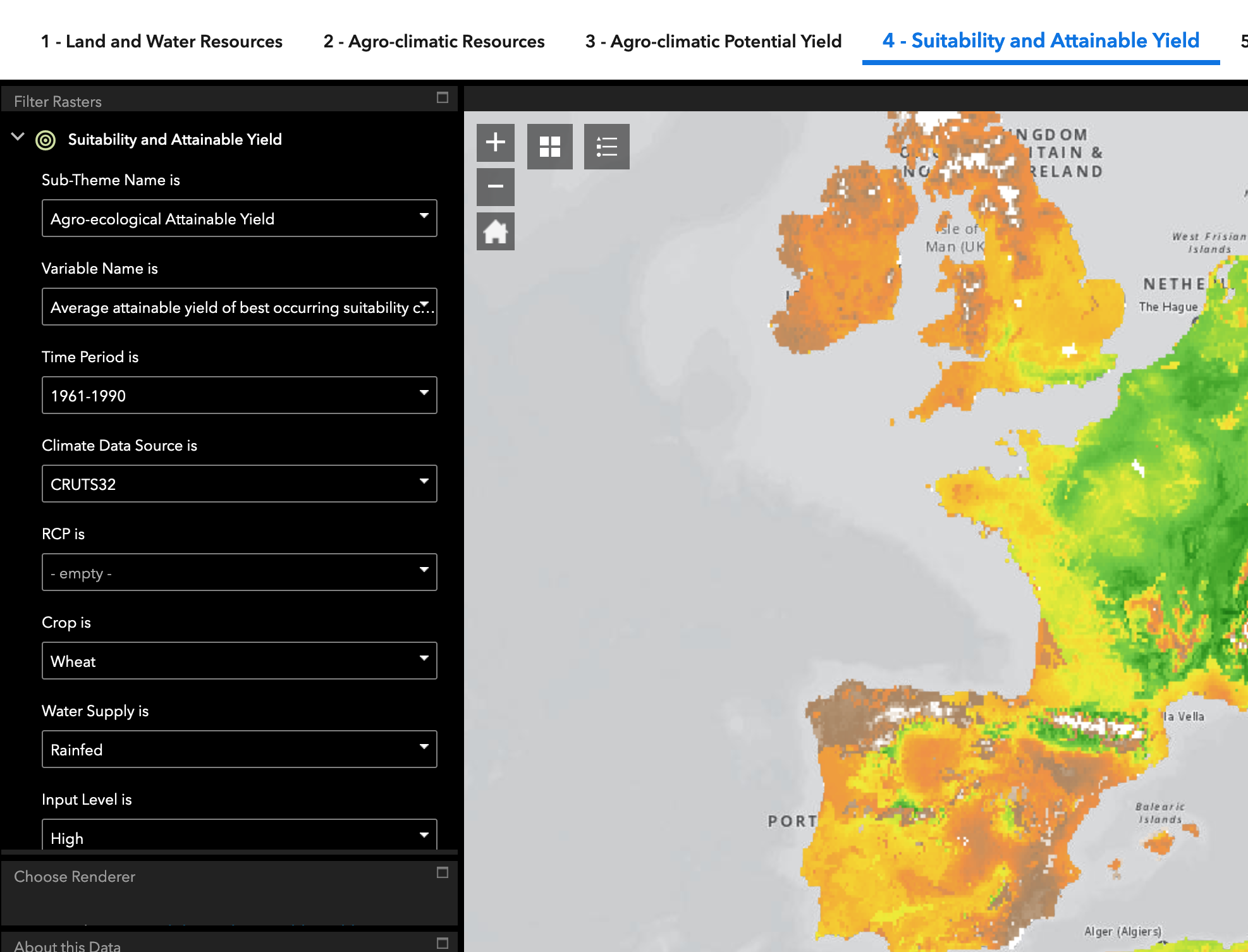
choose appropriate theme on top
Choose a variable (if known-else leave blank for default choice): not all variables are available in all combinations
Choose Time period (or leave blank)
Choose Climate Model. available via
climate_models()Choose RCP scenario (only if making extrapolation to the future): available via
rcps()Choose a crop. via
data(crops)Choose Water Supply. codes in
irrigation()Choose an input level (high or low)
Choose with or without CO2 fertilizer
The image on the right of the dropdown menus is your current raster, which can be downloaded. You will notice that not all data is available in all parts of the world.
How To Get the URL String
In the data viewer, zoom into a region of interest and click on an arbitrary pixel, as illustrated here:
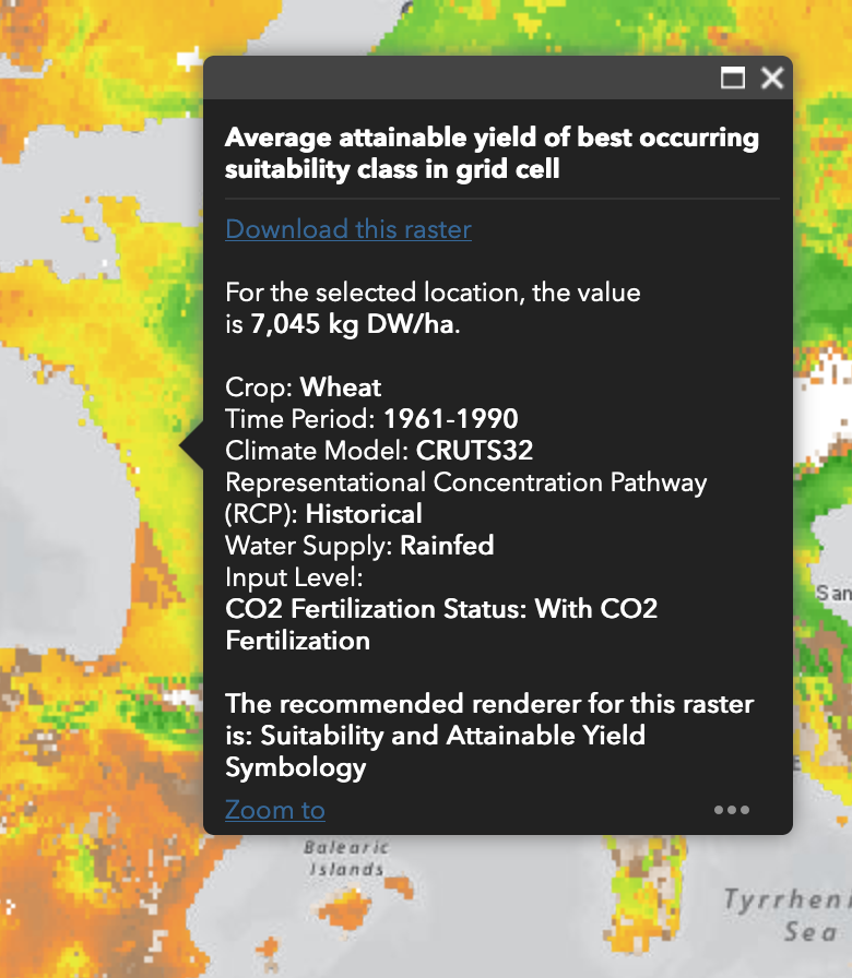
In the appearing popup menu, right click on link download this raster. It
will have a form like
https://s3.eu-west-1.amazonaws.com/data.gaezdev.aws.fao.org/res05/CRUTS32/Hist/6190H/ycHr0_whe.tif,
which composes as follows:
Base url:
https://s3.eu-west-1.amazonaws.com/data.gaezdev.aws.fao.orgGAEZ theme:
res05Climate Model:
CRUTS32Climate Scenario: Hist for past, one of several RCP scenarios for future.
Time Period:
6190Hstands for 1961 thru 1990 HistoricalThe Variable name:
ycHr0_whe.tifycstands for Average attainable yield of current cropland. Other values in Theme 4 are for exampleyl(Output Density (potential production divided by total grid cell area)) oryx(Average attainable yield of best occurring suitability class in grid cell)His the choice of input level (High or Low)rwhether rainfed (seeirrigation())0whether there is CO2 fertilization.wheis the crop code fromdata(crops).
Christophe Gouel wrote the core of this function. Florian Oswald rearranged and wrote the supporting documentation.
Examples
gaez_download("whe")